About the Osaka Metro Map & Guide
Organize your journeys, discover Osaka, analyze routes, and check the weather—all within a single application.
Osaka Metro Map & Guide – Your Vital Travel Ally in Japan‘s Lively City
Easily get around Osaka with Osaka Metro Map & Guide – the ideal application for tourists and everyday travelers alike. Whether you‘re wandering through Dotonbori, touring Osaka Castle, or heading to Universal Studios Japan, this app provides immediate access to transit maps, route planning features, and practical travel information—all in one convenient location.
🚇 Key Features:
🗺️ Effortless Route Planning
Seamlessly chart your course through Osaka’s metro and train systems with precise travel durations and comprehensive instructions.
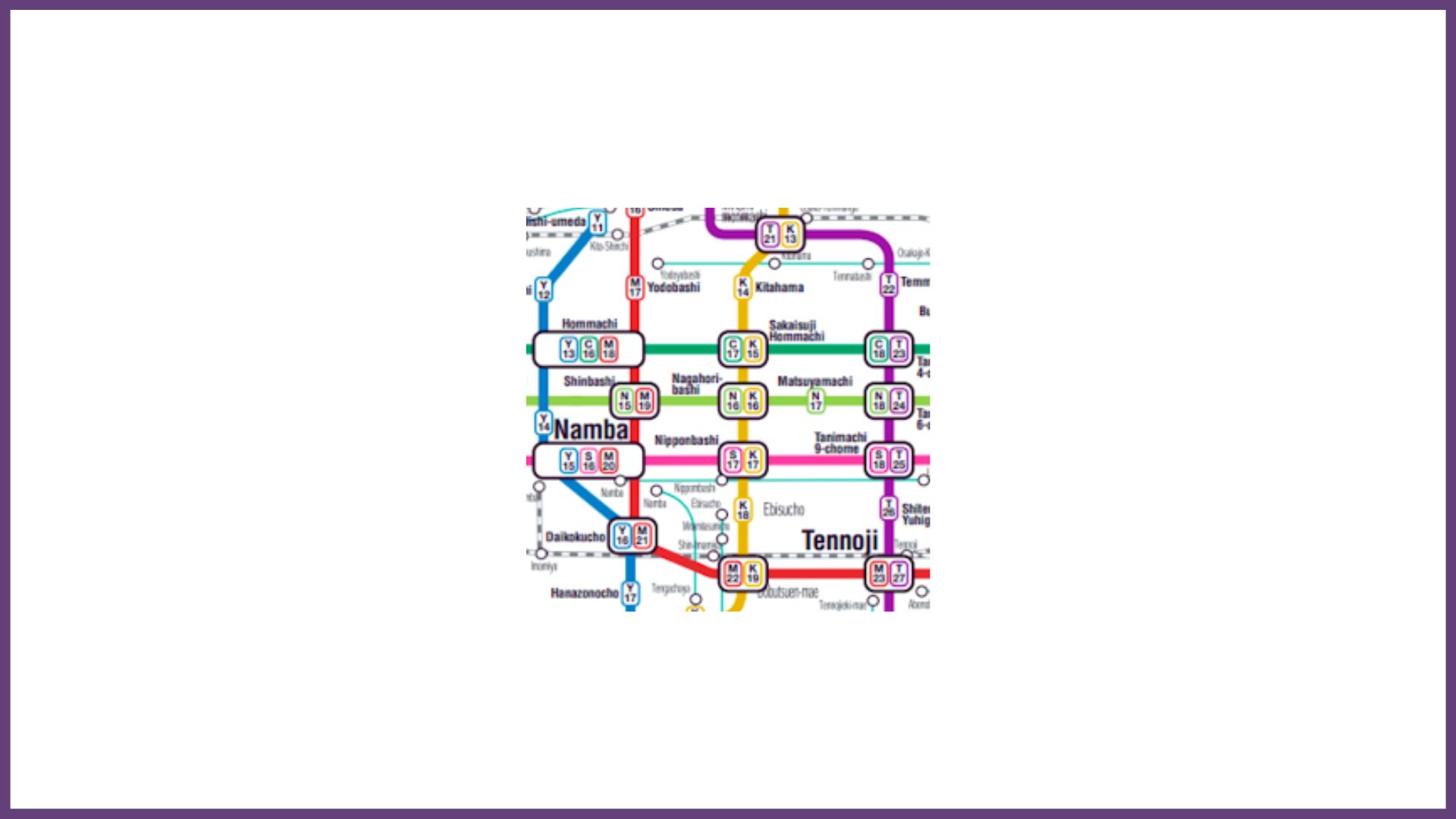
📍 Comprehensive Metro Map
Access a clear, user–friendly map of the Osaka Metro network, featuring all significant lines such as Midosuji, Tanimachi, Yotsubashi, and Chuo. Zoom, scroll, and navigate stations easily.
🌆 Integrated Tourist Guide
Uncover Osaka’s top landmarks including Osaka Castle, Dotonbori, Shinsaibashi, and Tsutenkaku—with nearby metro links and travel advice.
🎟️ Excursions & Experiences
Discover regional cultural activities, sightseeing excursions, and day trips directly through the app to enhance your experience.
☁️ Current Weather Updates
Keep informed with up-to-the-minute weather forecasts for Osaka to assist with your travel planning.
Whether for leisure or regular commuting, Osaka Metro Map & Guide ensures a smooth and confident journey through the city.
⚠️ Disclaimer
This application operates independently and is not officially associated with Osaka Metro Co., Ltd., JR West, or any governmental entity.
All maps and details are derived from publicly accessible data and are intended for general informational use only.


